
From the lush Amazon rainforest to the stunning drylands, Brazil boasts an extraordinary variety of landscapes that attract many outdoor enthusiasts every year. The country’s diverse ecosystems create a natural playground with trails that lead hikers of all experience levels through breathtaking vistas and rugged terrains. Here we list some of the best locations for amazing hikes in Brazil. Bear in mind that some areas have easy access from capitals and airports, while others demand complex logistics. So, one must always research the area before jumping into the adventure.
Northern states
Monte Roraima (RR) – Above the clouds.

Monte Roraima, often referred to as Romaima, stands as one of Brazil’s most iconic natural wonders and one of the few places on Earth that resisted human intervention. This majestic tabletop mountain, rising dramatically above the surrounding landscapes, is not only a feast for the eyes but also an invitation to explore one of the most unique ecosystems on the planet.
The trek to the top of Monte Roraima is a thrilling adventure that typically spans over six days, beginning in the quaint village of Paraitepuy. The path winds through diverse flora and fauna, offering glimpses of exotic wildlife that call this region home. Reaching the summit of Monte Roraima is nothing short of transformative. As you stand atop the flat-topped mountain, the panoramic vistas are awe-inspiring, stretching across the borders of Brazil, Venezuela, and Guyana. It’s a place where you can truly feel the pulse of the earth, surrounded by a surreal landscape that ignites your sense of wonder.

Getting there: The only way to hike Monte Roraima is through Venezuela. This is done through the Paraitepuy indigenous community, which is located 90 kilometers from the city of Santa Elena de Uairén, in Venezuela, and 320 kilometers from Boa Vista, the capital of the state of Roraima in Brazil.
When to go: It is possible to visit Monte Roraima at any time of the year. The rainy season runs from April to September and the less rainy season (there is no dry season up there) runs from October to March.
Main attractions: Tripla fronteira (the meeting point of the three countries). Lago Gladys (the biggest body of water of Monte Roraima). Vale dos Cristais (place with quartz crystals). Rocha Maveric (the highest point of Monte Roraima). Mirante La Ventana (panoramic viewpoint). Camping do Coati (a camp between two large rocks). El fosso (a deep lake in the middle of the rocks).
Length of stay: The trek to the summit of Monte Roraima takes at least 6 days. The climb itself involves 3 days of jungle trekking and challenging trails.
Difficulty: The expedition is challenging, but people of all ages and fitness levels can complete it.
Facts: Monte Roraima is the 8th highest peak in Brazil and it is part of a formation estimated to be 1.8 billion years old; The mount also served as inspiration for writer Arthur Conan Doyle to write the book ‘The Lost World‘.
Fees and rules: The entrance fee to climb Monte Roraima is not a single fee, but rather the cost of a tour package, which can vary significantly depending on the agency and the duration of the trek. These tours generally range from 6 to 10 days, including the climb, stay on the summit, and the return journey. Costs can range from around R$3,000 to R$10,000. Registered guide required.
Tips: After many kilometers of walking, make sure to enjoy the clear and refreshing water of the many natural jacuzzis that form between the rocks on top of Monte Roraima.
* Other trails in the Amazon forest
Choosing the best trail in the Amazon Rainforest depends on your level of experience, physical fitness, and what you are looking for in the experience. Options are endless, however, some stand out for their beauty and the variety of activities they offer.
For beginners and families: The Correição Trail at Cristalino Jungle Lodge (duration: 3 to 5 hours, easy/intermediate level) is a great option for those who want to experience the diversity of the forest, including areas that flood during the rainy season.
For those looking for a challenge: The Gocta Waterfall via Cocachimba in Peru (difficult level) is considered one of the most popular and challenging in the region, with spectacular views.
For those who want to explore the local culture: The Atlantic Amazon Trail (Belém to Viseu, 460 km) offers the opportunity to get to know communities, historical routes, and the socio-biodiversity of the region.
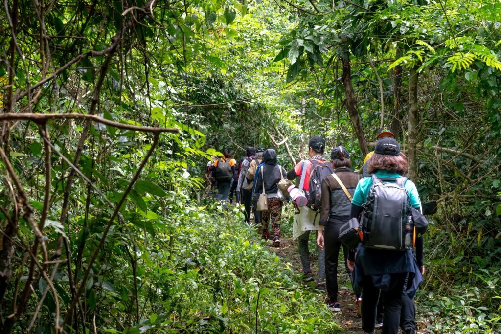
For those seeking an immersive experience: Flona Tapajós (Pará) offers trails guided by local guides, with the possibility of seeing centuries-old trees and supporting community-based tourism.
Since hiking throughout the rain forest can be quite daunting, we strongly recommend booking one of the expedition agencies which generally embraces a wide array of activities including hiking. Guided by people who really know the area, leaves your mind free to solely enjoy the wonders of the Amazon jungle.
Several reputable expedition agencies offer Amazon tours, each with unique strengths. For a blend of adventure and comfort, Amazonia Expeditions in Peru is a good choice. If you’re looking for a more hands-on experience, Amazon Green Tours in Brazil offers a unique cultural immersion. For a broader range of options, Travelstride provides a centralized platform with various tour companies and itineraries. Finally, National Geographic Expeditions offers a small group tour of the Upper Amazon, combining river cruises with land-based excursions. They are known for their expertise in wildlife photography and conservation.

Camping Tent with Rainfly, 2/3/4/6 Person Tent Sets Up in 10 Mins, Weatherproof Shelter for Camping, Festivals, Backyard, Sleepovers, & More
Jalapão (TO) – Golden and blues.

Jalapão, located in the state of Tocantins, is a hidden gem for outdoor enthusiasts seeking an unforgettable hiking experience in the Brazilian savannah. This extraordinary region is characterized by its stunning landscapes, featuring golden sand dunes, crystal-clear rivers, and unique vegetation. The natural springs, underground rivers that form natural pools, are one of the main attractions of Jalapão. There are more than 30 known springs, but few are open to visitors.
The region is also home to numerous trails that cater to various interests, including birdwatching and photography. The luckiest travelers who go on a trail in Jalapão can observe the appearance of some animals along the way, such as the maned wolf, the pampas deer, chameleons, and others. One of the most iconic hikes in Jalapão is the trek to the famous Duna do Jalapão. This massive sand dune rises dramatically from the surrounding landscape, providing panoramic views that will leave you in awe. As you hike up the warm golden sands, take a moment to appreciate the vibrant hues of the sunset that paint the sky in shades of orange and pink. This trail is perfect for hikers of all skill levels. Don’t forget your camera; the photo opportunities are endless!
For those looking for a more adventurous outing, the hike to the Cachoeira da Velha is a must. This impressive waterfall cascades down a series of rocky cliffs, creating a picturesque scene that feels straight out of a postcard. Once you arrive, take a refreshing dip in the natural pool at the base of the waterfall, a perfect way to cool off after your hike.
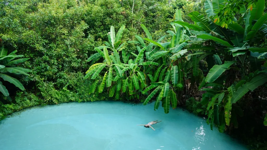
Getting there: The main gateway to Jalapão is Palmas, the capital of the state of Tocantins. From Palmas, you can take a direct flight to some cities in the region, such as São Félix do Tocantins or Porto Nacional, or rent a car and drive on dirt roads.
When to go: The best time to visit Jalapão is during the dry season, which runs from May to September, when the weather conditions are more favorable and the region is drier, with less chance of rain. This period is ideal for those who want to make the most of the waterfalls and springs.
Main attractions: Fervedouros/Springs (The Ceiça spring is the most famous and the first to be discovered; the Bela Vista spring is considered by many to be the most beautiful in the region). Lagoa do Japonês (a crystal clear lagoon). Cachoeira do Formiga (an emerald green waterfall). Cachoeira da Velha (a powerful waterfall). Cachoeira do Rio Novo (a river you can also go rafting). Cachoeira escorrega macaco and Roncadeira (pretty waterfalls). Dunas do Jalapão (Sand dunes. Don’t miss the sunset!). Serra do Espírito Santo (a beautiful lookout). Pedra Furada (an amazing rock formation). Canion Encantado and Sussuapara (two beautiful canyons).
Length of stay: An itinerary of at least 5 to 7 days to fully explore Jalapão is recommended.
Difficulty: The trails that cross Jalapão are, for the most part, short and flat. The most challenging is the one that leads to Serra do Espírito Santo.
Facts: The Jalapão region was once a sea; The name “Jalapão” has its roots in the jalapa plant, a species native to the region that was widely used by Indigenous people and local healers for its medicinal properties; Jalapão is home to several quilombola communities, descendants of African slaves who fled the farms and built their own villages in the region; The pressure of the water coming from the spring water table is so strong that it is impossible to sink!
Fees and rules: There is no entrance fee to Jalapão. It is possible to visit the park on your own, but it is recommended to have a professional guide. Jalapão is an isolated destination, with dirt roads and little signage.
Tips: A 4×4 car is essential, as the roads are dirt.
Northeast winds
Chapada das Mesas (MA) – As far as the eyes can see.

Chapada das Mesas is a beautiful national park located in the heart of Maranhão state characterized by dramatic plateaus, striking waterfalls, and an array of unique rock formations that create an otherworldly landscape.The region is home to several species of animals, including the wildcat, the crested curassow, the margay, the giant anteater, the puma, and the gray eagle. As you embark on your journey through this natural wonder, you will be met with a variety of trails that suit all skill levels.
One of the most popular hikes in Chapada das Mesas is the trail leading to the mesmerizing Cachoeira da Prata, a magnificent waterfall that cascades down a series of rocky ledges into a crystal-clear pool. For those seeking a more challenging adventure, the trek to the legendary Pedra Caída is an absolute must. Standing at an impressive height, this towering rock formation offers panoramic views of the surrounding landscape. The hike to reach the summit can be demanding, but the rewards are plentiful. Once at the top, you will be greeted with an awe-inspiring vista that stretches for miles. Remember to bring plenty of water and snacks, as the journey demands energy and perseverance.
Getting there: To get to Chapada das Mesas, you need to take a flight to Imperatriz, which receives flights from São Paulo, Brasília, Belém, São Luís and Belo Horizonte. From there, it is more 200km to Carolina, the base city for all tours.
When to go: The dry season (May to September) is the most recommended for activities such as trekking, as the trails are in better condition. Avoid July and holidays, these periods tend to have a greater flow of tourists.
Main attractions: Poço Azul and Encanto Azul (two wells of crystal clear water). Morro do Chapeu (ideal for those looking for difficult trails). Waterfalls – Prata, São Romão, Santa Bárbara, Santa Paula, Complexo Pedra Caída, among others.
Length of stay: To get to know Chapada das Mesas, the ideal is to dedicate at least 5 full days. However, to explore the region calmly and visit more attractions, 7 days is recommended.
Difficulty: The difficulty of activities in Chapada das Mesas varies depending on the specific trail or tour. Generally, the most common trails are of a moderate level, with some being considered easy or more challenging.
Facts: The region is characterized by table-shaped sandstone rock formations, carved by erosion over 70 millions of years.
Rules and Fees: The entrance fee to the Chapada das Mesas is R$20 per person. For sunrise, the fee is R$30 per person. Hiring local guides is recommended.
Tips: Explore the surounding of the park. In the region, 89 waterfalls and more than 400 springs have been found, which is why the area is nicknamed the Water Paradise.

Serra da Capivara and Serra das Confusoes (PI) – A low-key wonder.
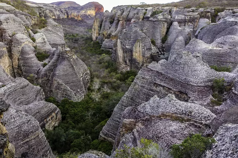
The Serra da Capivara and Serra das Confusoes are located in the heart of the state of Piauí and offer stunning landscapes and rich cultural heritage. These two national parks protect one of the best-preserved stretches of the Brazilian semi-arid biome. As you walk its rugged trails, you’ll find yourself immersed in a world of breathtaking vistas, unique rock formations, and unique wildlife. You will be surrounded by an atmosphere that feels untouched by modernity.
The parks harbour a mesmerizing tapestry of vegetation, including cacti, colorful wildflowers, and lush patches of forest. Wildlife enthusiasts will find Canion do Viana particularly enchanting. Keep your eyes peeled for unique species of birds, butterflies, and even small mammals that inhabit the region. This stunning canyon, carved by the forces of nature over millennia, offers an unparalleled hiking experience that combines thrilling adventure with the serenity of untouched wilderness.
In addition to its natural splendor, Serra da Capivara is steeped in history. The park houses some of the oldest rock art in the Americas, with thousands of prehistoric paintings that offer a glimpse into the lives of ancient peoples. Besides, one of the most rewarding aspects of hiking the area is the chance to encounter breathtaking natural formations, such as striking cliffs, deep canyons, and hidden waterfalls. These geological wonders provide perfect spots for rest and reflection, allowing you to soak in the scenery and maybe even capture the perfect photograph.

Getting there: You have 3 options for getting to Serra da Capivara. The first is by plane. There is a small airport in São Raimundo Nonato that receives flights on Tuesdays, Thursdays and Sundays from Recife. Another very common option is for people to fly to Petrolina and from there rent a car to go to São Raimundo Nonato. And, of course, use the car to visit the park. Buses also operate on Sundays, Mondays and Thursdays. Access to Serra das Confusões National Park is via the city of Caracol, on the border with the state of Bahia. To get there, follow the BR-343 and PI-140 (Transpiauí) highways to São Raimundo Nonato. From there, it is another 80 kilometers along the PI-144 to Caracol. From Teresina (PI) the best access option is to take the BR-316 heading south.
Main attractions: Serra da Capivara – Painéis de pinturas e gravuras rupestres (cave paintings). Desfiladeiro da Capivara (a beautiful canyon). Boqueirão da Pedro Furada (an interesting rock formation). Baixão do Sítio do Meio, Baixão das Andorinhas, and Baixão do Perna (valleys); Serra das Confusoes – Mirante Janela dos Sertões (a beautiful lookout). Gruta Riacho do Boi (a cave). Janela da Ventania (a rock formation). Toca do Capim (a rock formation). Pinturas Rupestres na Toca do Enoque (cave paintings).
Length of stay: It is recommended to spend between 3 to 6 days in each park.
Dificulty: From low to high, depending on the circuit and the activity.
Facts: Serra da Capivara National Park is one of the largest and most important archaeological sites in the world; It is listed on the UNESCO World Heritage List; The fossil megafauna of the national park includes more than 30 species, the largest of which (a giant sloth and a mastodon) weighed more than 5 tons; The findings call into question theories about the migration process to the AmeriFees and rules: Entrance to Serra da Capivara National Park costs R$14.00 per person, and it is mandatory to have an accredited guide to visit the park. Entrance to Serra das Confusões National Park is free, but it is also highly recommended to hire a local guide for a safer and more informative visit.
Lençóis Maranhenses (MA) – Get your gob smashed!

Lençóis Maranhenses National Park is a breathtaking wonder located in the northeastern state of Maranhão, Brazil. This unique landscape is characterized by vast stretches of white sand dunes interspersed with stunning freshwater lagoons that fill during the rainy season, creating a surreal environment. As you embark on a hiking adventure through this national park, you will find yourself immersed in one of the most extraordinary ecosystems Brazil has to offer, where every step unveils a new spectacle of nature’s artistry.
The park stretches over 155,000 acres, offering a variety of trails for all different skill levels. One of the most popular routes is the trek from the village of Atins to the Lagoa do Paraíso. This well-marked trail leads you through the undulating dunes, offering panoramic views that seem to stretch into eternity. The sight of the turquoise waters nestled against the white sands is nothing short of breathtaking. For those seeking a more adventurous experience, consider exploring the lesser-known trails that weave through the park. These paths often lead to hidden lagoons and secluded areas where you can enjoy the tranquility away from the more crowded spots.

Getting there: To get to Lençóis Maranhenses, you can fly to São Luís and then take a bus, car or transfer to the towns of Barreirinhas, Santo Amaro or Atins.
When to go: The best time to visit is between June and September when the lagoons are at their fullest, providing a tranquil and refreshing oasis amidst the dunes.

Main attractions: Lagoa Bonita and Lagoa Azul (famous for their crystal clear waters and stunning landscapes). Rio Preguiças (beautiful river). Praia de Atins (Paradise beach with dunes, lagoons and a peaceful atmosphere). Lagoa Betânia (One of the most beautiful lagoons in the park, with calm waters and stunning landscapes). Lagoa da Gaivota (known for being a nesting spot for seagulls and for its beautiful landscapes). Lagoa das Andorinhas (another crystal clear lagoon).
Length of stay: For a complete visit to Lençóis Maranhenses, between 5 and 7 days are recommended.
Difficulty: The trails in Lençóis Maranhenses can be moderate, intermediate, difficult or extreme, depending on the distance, walking time and level of adventure.
Facts: There are more than 36 thousand lagoons in the park, are large enough to fit the whole city of New York inside.
Fees and rules: There is no entrance fee in the park. However, accredited agencies and tour operators within the park do charge fees for their services, such as required guided tours and transportation.
Tips: It is possible to spend the whole night in the park. The temperature drops a little, but it is not unpleasant. If you catch the right moon, the place is lit up and the sky becomes a carpet of stars since there is almost no city nearby. It is worth the trip! During the day, always remember to carry plenty of water and sun protection, as the sun can be intense while you traverse the open dunes. Lagoon ecosystems are extremely fragile; make sure to use an eco-friendly SPF.

Chapada Diamantina (BA) – A classic!
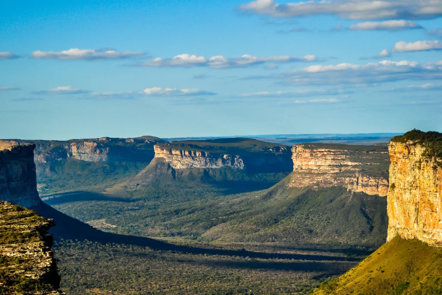
Chapada Diamantina is an amazing national park located in the heart of the state of Bahia, renowned for its stunning landscapes, diverse ecosystems, and rich cultural heritage. Spanning over 152,000 hectares, this unique region is characterized by its dramatic plateaus, deep valleys, and striking rock formations. One of the most iconic features of Chapada Diamantina is its impressive topography, which includes the famous Table Mountains, or “Chapadas.” These flat-topped mountains rise sharply from the surrounding landscape, creating a striking contrast with the lush valleys below.
The biodiversity within Chapada Diamantina is remarkable, with a wide range of ecosystems. The park is home to numerous endemic species, including birds like the endangered blue-winged macaw and unique reptiles. Hikers may also encounter a rich variety of vegetation, from dense tropical forests to arid savannahs, each supporting a distinct community of life. The park is a hiker’s paradise, offering a variety of trails that cater to all skill levels, from leisurely walks to challenging treks. Visitors can expect to encounter spectacular waterfalls, expansive caves, and unique nature.

The Chapada Diamantina features numerous beginner-friendly trails. One popular option is the Fazenda Pratinha Trail, which winds through lush vegetation to the beautiful Pratinha River. Another accessible choice is the Morro do Pai Inácio Trail, known for its breathtaking views and unique rock formations. This well-defined trail takes about an hour to reach the summit, rewarding hikers with panoramic vistas of the Chapada Diamantina landscape. The Riachinho Waterfall Trail is also great for beginners, featuring a short, flat path that leads to a picturesque waterfall—perfect for a picnic or a dip. For a slightly longer hike, the Vale do Capão Trail presents a charming mix of valleys, cliffs, and diverse vegetation.
Another fantastic option for those seeking adventure is the trail leading to the Cachoeira da Fumaça, one of Brazil’s tallest waterfalls. Although longer, it remains manageable for novice hikers and leads to one of Brazil’s most beautiful waterfall. Finally, a classic intermediate/advanced trail is the Vale do Pati. This iconic route spans approximately 70 kilometers and can be completed in four to five days. In the heart of Chapada Diamantina lies a network of hidden gems and lesser-known trails that offer a unique perspective on the region.

Getting there: The City of Lençois is the gateway to the Park. Getting to Lençóis by bus is easy from Salvador, the capital of the state of Bahia. The journey is 420 kilometers (261 miles) and takes around 7 hours. Alternatively, you can get a flight from Salvador with Azul Airlines. Flights only leave to and from Lençóis on Thursdays and Sundays. The flight takes just over an hour and they leave from Salvador International Airport.
When to go: You can visit the park at any time of the year. November to April is the rainy season. This isn’t necessarily a bad thing as it makes the waterfalls even more spectacular. However, New Years’ and Carnival (January to March) is the busiest period of the year. August to October is the region’s dry season. During this time Chapada Diamantina is dry and all the waterfalls around will have less water flowing.
Main atractions: Morro do Pai Inacio (considered the postcard of Chapada Diamantina). Vale do Pati (beautiful valley). Grottos and pools – Gruta da Lapa Doce, Gruta da Pratinha, Gruta da Fumaca, Gruta Azul, Poco Azul, Poco Encantado, Poco do Diabo, Ribeirao do Meio. Waterfalls – Cachoeira da Fumaca (one of the tallest waterfall in Brazil), Cachoeira do Sossego, Cachoeira dos Mosquitos, Cachoeira do Buracao.
Length of stay: To make the most of Chapada Diamantina and see the main attractions, we recommend a period of at least 7 days (minimum of 3 days).
Difficulty: The difficulty of the trails in Chapada Diamantina varies significantly, from easy trails for leisurely walks to more challenging trails for experienced adventurers.
Facts: Lençóis in Chapada Diamantina, was the world’s largest producer of diamonds; The Panama Canal, the subways in Buenos Aires, New York, and Paris were built with diamonds cut from Chapada Diamantina; Pico do Barbado is the highest peak in northeastern Brazil, at 2,033 meters above sea level; The city of Lençóis had once 25 thousand inhabitants and was the capital of the “Diamantina Mines”
Fees and rules: There is a R$20 entrance free, valid for three consecutive days. it is possible to visit the chapada without a guide. but for security reasons a guide is recommened.
Tips: Save one or two days to enjoy the chilled vibe of Lencois. This pretty colonial town has amazing local food and landmarks.
Central hights
Chapada dos Guimarães (MT) – Flat it out!

Parque Nacional da Chapada dos Guimarães is a breathtaking plateau that deserves a spot on every hiking enthusiast’s bucket list. Jusr a short drive from the vibrant city of Cuiabá, this national park offers an incredible array of trails to all levels of outdoor adventurers. As you step into this stunning landscape, you’ll be greeted by dramatic cliffs, cascading waterfalls, and a diverse range of flora and fauna that make every hike a unique experience. The park is also a fantastic destination for those interested in cultural experiences. Along the trails, you’ll encounter ancient rock formations adorned with indigenous petroglyphs, offering a glimpse into the region’s rich history.
One of the most iconic hikes in the park is the trail to the Mirante do Centro Geodésico, where you can marvel at panoramic views that stretch as far as the eye can see. The hike is relatively easy, making it accessible for families and those new to hiking. Colorful birds, playful monkeys, and even the elusive jaguar may be spotted if you’re lucky. For those seeking a more challenging adventure, the trail to the Cachoeira do Véu de Noiva is a must-try. This hike will take you through lush vegetation and rocky terrain, culminating in a stunning waterfall that cascades down like a bridal veil.
Getting there: The best way to get to Chapada dos Guimarães is to take a flight to Cuiabá International Airport (CGB) – which, luckily, is only 80 km from the municipality of Chapada dos Guimarães. There are bus options that depart regularly from Cuiabá towards Chapada.
When to go: The dry season, from May to September, offers milder temperatures and ideal conditions for trails and waterfalls. The rainy season, from October to April, brings larger waterfalls and lush gardens, ideal for those who prefer nature at its most vibrant.
Main Attractions: Cachoeira Véu de Noiva (the most famous waterfall of the park). Morro de São Jerônimo (mount with a beautiful lookout). Trilha do Circuito das Cachoeiras (trail taking you to many of the main waterfalls). Cidade de Pedra (‘Stone Town’; is one of the most stunning spots in Chapada); Circuito das Cavernas (trail along some of the best caves). Ponte de Pedra (natural stone bridge with fantastic view of the cliffs and the surrounding cerrado forest). Poco verde e Poco das antas (natural water springs). Lagoa Azul (a stunning cave with a turquoise lagoon formed by water that springs from the rock).
Difficulty: Chapada dos Guimarães offers hikes of different levels of difficulty, from easy trails to more challenging hikes.
Facts: Chapada dos Guimarães was once the largest municipality in Brazil, with 269 thousand km²; The region has 46 archaeological sites, with rock inscriptions and paintings made by ancestors; The region was, 64 million years ago, an ancient dinosaur pasture; The region is the sources of several important rivers, including the Paraguay, Araguaia, Tocantins, Juruena-Tapajós and São Francisco rivers.
Fees and rules: Entrance to the park is free. To explore the park, you can choose from different types of guidance, from self-guided trails to tours with specialized guides.
Tips: save some hours to visit the Natural History Museum of Mato Grosso!
Chapada dos Veadeiros (GO) – Moon-like adventure.

Chapada dos Veadeiros National Park is a unique place in Brazil’s diverse landscape, offering an array of hiking trails to adventurers of all skill levels. Nestled in the heart of the Brazilian highlands, this UNESCO World Heritage site is known for its stunning plateaus, dramatic cliffs, and a plethora of waterfalls. Nature enthusiasts will find Chapada dos Veadeiros to be an exceptional destination for birdwatching and wildlife observation. The park is home to a range of species, including the endangered Lear’s macaw and various types of monkeys.
The Saltos Trail is one of the most popular, leading to impressive waterfalls, with the Carrossel Waterfall standing out. The Sete Quedas Trail is a longer and more challenging trail, while the Seriema Trail is an easier option, perfect for beginners. Another very popular trail in the park is the one leading to the iconic Cachoeira Santa Bárbara. This hike is relatively moderate. The trail winds through lush vegetation and rocky terrain, ultimately rewarding you with the sight of the stunning turquoise waters of the waterfall. The refreshing swim at Santa Bárbara is an experience you won’t forget, providing a perfect opportunity to cool off and connect with the beauty of your surroundings.
For the more adventurous, the challenging trek to the Vale da Lua is a must. This trail takes you to a surreal landscape of eroded rock formations that resemble a lunar surface, hence the name. In addition to its stunning hikes, Chapada dos Veadeiros is also a place of spiritual significance. Many visitors come to experience the energy of the region, often referred to as a healing space. Whether you seek adventure, tranquility, or inspiration, the park’s serene environment encourages a deep connection with nature.

Getting there: The closest airport to Chapada dos Veadeiros is Brasília International Airport. Once there, the best option is to rent a car and continue your journey to Alto Paraíso de Goiás (242 km), São Jorge (257 km) or Cavalcante (355 km), the three cities in Chapada most sought after by travelers.
When to go: The best time to visit Chapada dos Veadeiros is at the end of the rainy season and beginning of the dry season, usually between April and July. This period offers pleasant weather, with waterfalls in full flow and vegetation still green. However, Chapada dos Veadeiros can be visited all year round, with each season offering its own unique charm.
Main attractions: Cachoeira dos Couros (one of the jewels of the Chapada, with its crystal-clear waters and natural pools).Vale da Lua (a rock formation sculpted by nature, with a unique setting and lunar landscape). Cachoeira Santa Bárbara (stunning turquoise waters, it is one of the region’s postcards). Trilha dos Cânions (a trail with stunning views and the chance to see Cânion II and Cachoeira das Cariocas). Waterfalls around São Jorge (explore Cachoeira do Segredo and other waterfalls with trails and natural pools).
Trails difficulty: Chapada dos Veadeiros offers trails for all levels of experience, from easy walks for families and seniors to more challenging trails for experienced hikers. The Travessia das Sete Quedas is considered the most difficult, with a length of 23 km and the need to spend the night halfway along the route.
Facts: In 2001, UNESCO granted Chapada dos Veadeiros the title of Natural Heritage of Humanity; IChapada is known as the capital of mysticism, it is believed that the subsoil of Chapada dos Veadeiros has a huge quartz plate, attracting visitors looking for positive energy and a mystical place.
Fees and rules: Entrance to Chapada dos Veadeiros National Park costs R$47.00 for general visitors. In Chapada dos Veadeiros, several waterfalls can be visited without a guide, such as Vale da Lua, Cachoeira do Segredo and Trilha dos Saltos. However, some attractions, such as Cachoeiras Almécegas I and II and some in Complexo do Prata, may require a guide in certain situations, especially during the rainy season, due to the risk of waterspouts.
Tips: The cuisine of Chapada follows the Goiano style, with many delicious dishes. But the place also offers numerous restaurants, snack bars, cafes and bakeries.

Extra Wide & 3″ Thick Sleep Support
30s Inflate & 1s Deflate
Ultralight & Easy to Carry
Resistant 40D Nylon
Bonito, Serra da Bodoquema and Pantanal (MS) – Wet and wild.

Bonito, Serra do Bodoquena and Pantanal are destinations that cannot be missed on the travel itinerary of those who enjoy ecotourism and activities surrounded by nature. The Serra da Bodoquena is 70 km away from Bonito, and Pantanal is about 85 Km ahead from Bodoquema.
The Pantanal, one of the world’s largest tropical wetlands, is a breathtaking destination that amazes outdoor enthusiasts with its vast landscapes and rich biodiversity. Spanning over 75,000 square kilometers across Brazil, Paraguay, and Bolivia, the Pantanal is a hiker’s paradise, offering an array of trails that wind through lush vegetation, winding rivers, and stunning wildlife.
The Pantanal’s landscape is ever-changing, showcasing a vibrant palette of colors and textures, particularly during the wet season when the area transforms into a shimmering expanse of water. Hiking during this time allows you to witness the dynamic interplay of land and water, making it a particularly magical experience.
From easy walks along the riverbanks to more challenging treks that take you through dense forests, every path offers an opportunity to witness the incredible diversity of flora and fauna. Keep your eyes peeled for capybaras lounging by the water, colorful macaws soaring overhead, and the elusive jaguar stealthily moving through the underbrush.
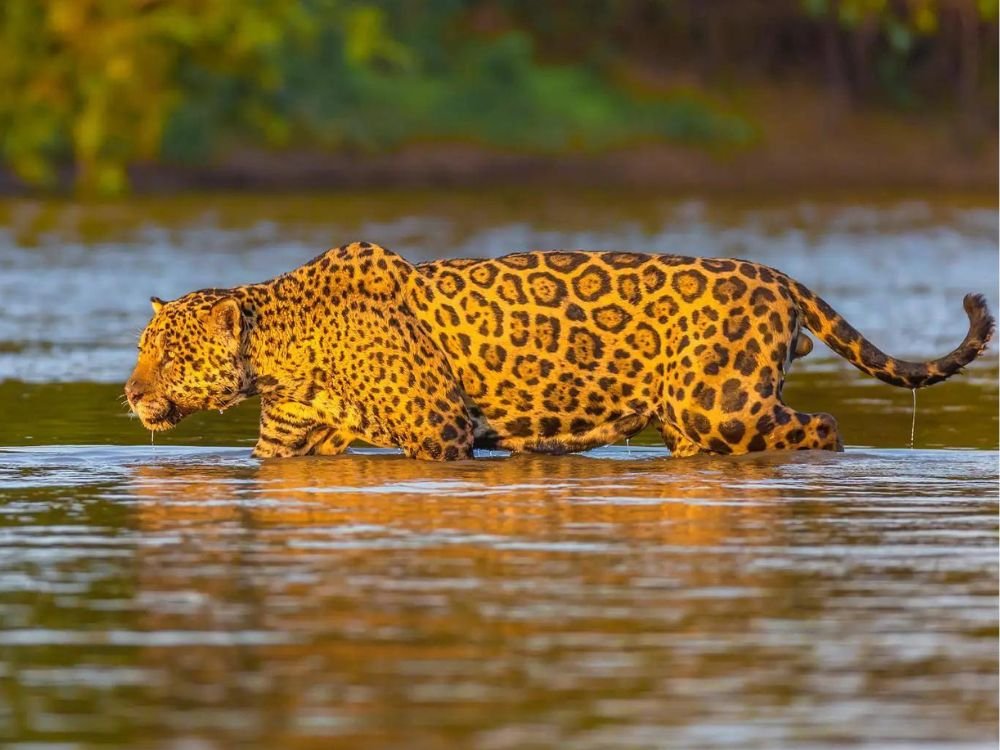
Bonito is a gem nestled in the heart of Brazil’s Mato Grosso do Sul state. Renowned for its vibrant ecosystems, and crystal-clear waters, Bonito offers an array of hiking trails to every level of adventurer.

One of the most captivating aspects of hiking in Bonito is the opportunity to witness its unique geological formations. The region is famous for its limestone caves, which have been shaped over millennia by the flowing waters that carve through the rock. Trails such as the hike to the Gruta do Lago Azul allow you to marvel at stunning stalactites and stalagmites while leading you to an underground lake that shimmers in hues of blue.
For those looking to immerse themselves in Bonito’s lush flora and fauna, the hike to the Rio da Prata is an experience not to be missed. This trail meanders through a vibrant ecosystem teeming with life, where you may encounter diverse species of birds, colorful butterflies, and perhaps even a capybara or two. The path leads to a breathtaking river where you can snorkel among schools of fish in crystal-clear waters. This combination of hiking and aquatic adventure provides a unique perspective on the region’s biodiversity and will undoubtedly leave you in awe of nature’s wonders.

Once in Bonito, a visit to Serra da Bodoquema National Parque is definately a good idea.
Located 70 km from the city of Bonito/MS, the waterfalls of Serra da Bodoquena are a spectacle of nature in the heart of Mato Grosso do Sul. The Serra da Bodoquena Waterfalls Trail begins with a 2,500 m route through the forest and passes waterfalls and natural pools, totaling 8 stops for bathing and a boat trip along the Betione River.
Getting there: The best way to go to Bonito/Serra da Bodoquema is from Campo Grande, the capital of MS. Once in Campo Grande, the most convenient way to reach Bonito is by renting a car and driving. The drive takes around 3 hours and 30 minutes and about an extra hourto reach Pantanal.
When to go: The best time to visit the Pantanal, Bonito and Serra da Bodoquema is from May to October, covering the intermediate and dry seasons. This period is ideal for wildlife watching and outdoor activities. During this period, the rivers and waterfalls are clearer and there is less chance of rain. However, if you don’t mind a little rain, summer (from December to March) is also a good option, especially for those who like full waterfalls.
Main attractions: In Pantanal: Caminho das Águas (trail through waterways, crystal-clear rivers and waterfalls). Rota das Palmeiras (a walk flanked by ancient palm trees). Caminho dos Planaltos Misteriosos: a trail to the high terrains of the Pantanal). Selva encantada (an immersive trail through dense forest). Trails at Farms/Eco-lodges (many eco-lodges and farms in the Pantanal offer guided trails for guests, allowing for a more personalized experience). In Bonito/Bodoquema: Rio Sucuri (has some of the most crystal clear water in the world). Gruta Catedral (impressive rock formations and a nice panoramic view of the region). Eco Park Porto da Ilha (a 3-hectare ecological conservation area where tourist activities are carried out for the whole family). Cânions do Salobra (Canyon with crystal clear water running through). Cachoeiras Serra da Bodoquena (many). Rio Azul (stunning blue clear water river).
Length of stay: To adequately explore both Bonito and the Serra da Bodoquena region, a week is recommended. A shorter trip, like 4 days, can still allow you to experience some of the top attractions. An extra 4 days is recommented to visit Pantanal
Difficulty: Most trails in the area are easy. The Bonito trails, including those in Serra da Bodoquena, are generally considered easy to moderate. Bonito trails are particularly suitable for families.
Facts: The Pantanal is the size of Portugal, Belgium, Switzerland and the Netherlands together. If the Pantanal were a country, it would be ranked 39th in terms of biodiversity in the world;
It is the biome with the largest native vegetation coverage (proportionally) in Brazil.
Fees and rules: In Pantanal, guided tours are available and highly recommended, as local guides possess an intimate knowledge of the area and can help you spot wildlife that you might otherwise miss. The Serra da Bodoquena region in Bonito, Brazil, offers various attractions with varying entrance fees.
Tips: Book a 4×4 safari through the road of Pantanal. Go “piranha” fishing in Rio Miranda. And if you dare, jump in the water with them (unless you have an open wound or scar). Pantanal is also a great place for those into horse riding!
South-east breeze
Serra da Canastra National Park (MG) – Stream by stream.

Serra da Canastra National Park is a breathtaking range nestled in the heart of Brazil, offering adventurers an unparalleled experience of nature’s beauty. The park spans over 200,000 acres and is home to diverse ecosystems, including lush forests, cascading waterfalls, and expansive plateaus. One of the highlights of hiking in Serra da Canastra is the chance to witness the park’s rich biodiversity. It is a sanctuary for a wide variety of flora and fauna, including the rare maned wolf and the Brazilian cerrado‘s unique plant species.
The trails in Serra da Canastra suit all levels of hiking experience. The most popular route, the Rio São Francisco Trail, offers a moderate challenge with rewarding views of the iconic waterfall, Cascatinha do Fervedouro. This trail allows you to immerse yourself in the enchanting scenery, as you follow the river and witness the stunning geological formations that characterize the park.
For those seeking a more exhilarating adventure, the park features several challenging hikes that lead to panoramic viewpoints. The trek to the top of the Canastra Plateau has a steep ascend but the breathtaking vistas at the summit make every effort worthwhile.
/

Getting there: There are several ways to reach Serra da Canastra National Park, depending on your starting point. If you are flying into Brazil, the closest major airport is Belo Horizonte International Airport. From there, you can either rent a car or take a bus to São Roque de Minas, the nearest town to the park. Alternatively, you can also hire a local guide or join a tour group for a hassle-free journey.
When to go: The best time to visit Serra da Canastra National Park is during the dry season, which runs from May to September. During this time, the weather is mild, and the waterfalls are at their most impressive. It is important to note that the park can get quite crowded during the peak tourist season, so if you prefer a more tranquil experience, consider visiting during the shoulder seasons.
Main Attractions: Cachoeira Casca d’Anta (the main attraction of the National Park, with two options for visiting, the lower and upper parts, with views and natural pools). Cachoeira da Chinela (a waterfall with a pool for swimming). Cachoeira Rasga Canga (an option for those seeking more adventure, with waterfalls and natural pools). Cachoeira do Cerradão (located in a Private Natural Heritage Reserve (RPPN), with trails and river bathing). Other options – Cachoeira dos Rolinhos, Cachoeira do Fundão. Trails (several trails for hiking and contact with nature). Nascente do Sao Franscisco (the source of the largest river entirely within Brazil). Curral de Pedras (a tourist spot with a panoramic view of the region). Fazenda da Canastra (a farm that produces cheese and other regional products).
Difficulty: The Serra da Canastra National Park in Minas Gerais, Brazil, offers a variety of trails, many of which are rated as “hard” due to elevation gain and rocky terrain. This means they are likely to be challenging for hikers and may require a moderate level of fitness and experience.
Facts: The Serra da Canastra is a kind of river nursery located right on the divide between two hydrographic basins: the Paraná River and the São Francisco River; The Serra da Canastra received this name because of its shape, which resembles a “chest” or “canastra” (an ancient form of ark) when seen from afar.
Fees and rules: The Serra da Canastra National Park currently does not have an entrance fee as the collection of visitation fees is temporarily suspended. The park offers several opportunities for self-guided activities, such as hiking and trails. However, for a safer and more complete experience, it is recommended to be accompanied by an accredited guide or driver.
Tips: The road that cuts through the park is in poor condition. Therefore, it is worth hiring local guides with 4×4 vehicles in São Roque de Minas. Visit the other municipalities that make up the Serra da Canastra region: Delfinópolis, Sacramento, São João Batista do Glória and Capitólio.

COMFORTABLE SEATING
CONVENIENT BEVERAGE STORAGE
BUILT-IN CUP HOLDER
DURABLE AND STRONG
EASY TRANSPORTATION.
$29.99
Itatiaia and Mantiqueira Range (RJ/SP/MG) – Chill out!
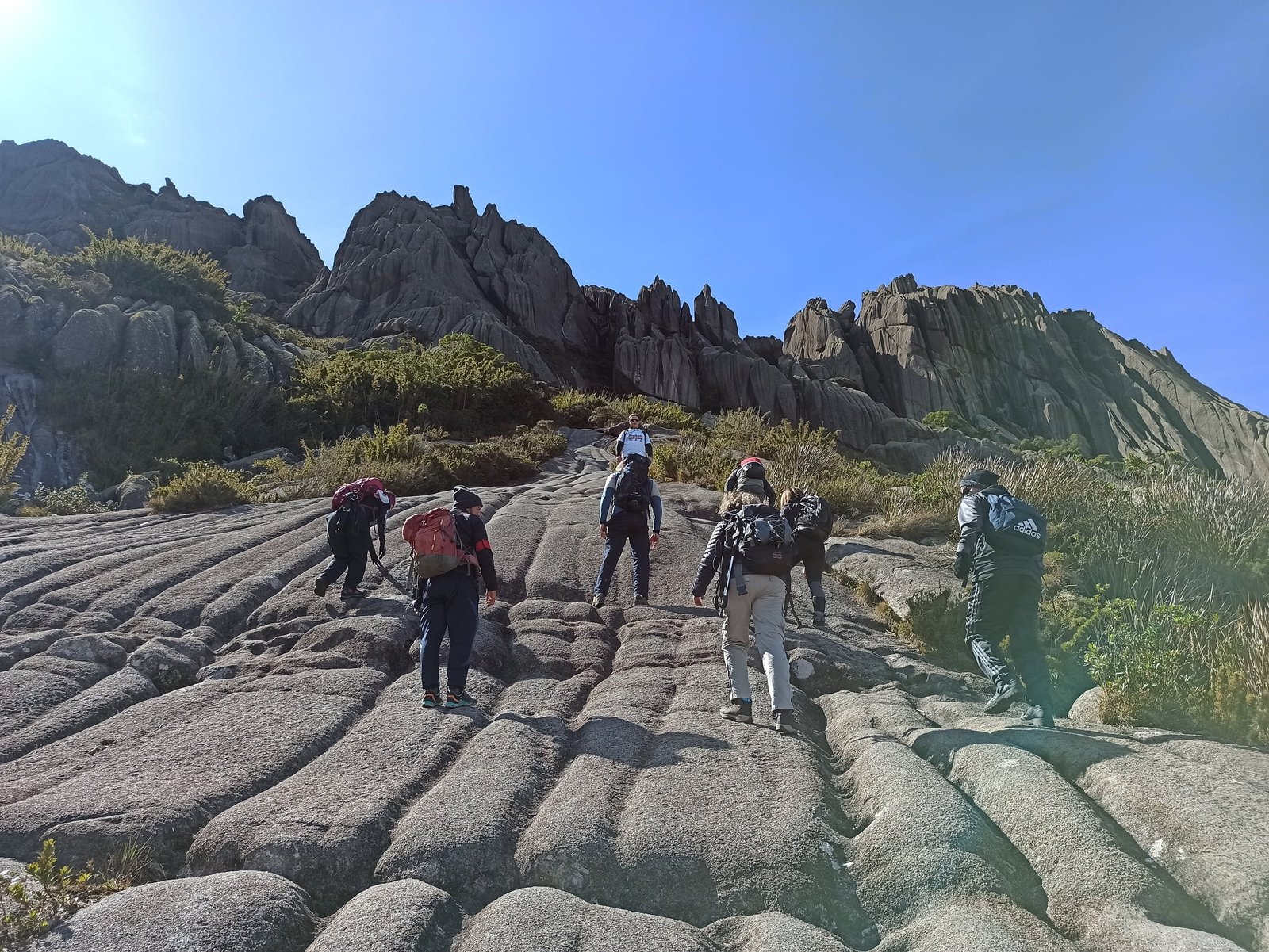
Pico das Agulhas Negras, Itatiaia.
Nestled between the states of Minas Gerais, São Paulo, and Rio de Janeiro, this mountain range boasts some of Brazil’s most beautiful scenery, characterized by dramatic peaks, lush valleys, and cascading waterfalls. The diverse ecosystems you encounter along the trails are teeming with unique flora and fauna, making every hike an unforgettable adventure. The park is home to a variety of species, including the endangered golden lion tamarin and numerous bird species that fill the air with their melodious song.
One of the highlights of the Mantiqueira Range is the iconic Pico das Agulhas Negras within the Itatiaia National Park, the highest peak in the region. Standing at 2,791 meters, this majestic summit offers a challenging yet rewarding hike that attracts adventurers from all over.
For those seeking a more leisurely experience, the trails around the park’s lower elevations are equally enchanting. The Trilha dos 7 Lagos (Seven Lakes Trail) meanders through vibrant landscapes, showcasing the park’s diverse flora and fauna. Each lake presents a unique charm, inviting you to pause and appreciate the tranquility surrounding you.
Getting there: Departing from Rio de Janeiro or Sao Paulo, the Presidente Dutra Highway (BR-116) and BR-354 are the main roads leading to the park.
When to go: The best time to visit Itatiaia, in the Serra da Mantiqueira, is during the dry months, between April and October. This period offers milder temperatures and less rain, making it easier to hike and visit waterfalls, especially in the upper part of the National Park.
Main attractions: Rock peaks – Pico dos Cones, Pedra do Sino, Pedra do Altar, Pedra da Maçã & Tartaruga, Pedra Assentada, Ovos de Galinha. Massifs – Prateleiras, Agulhas Negras. Lakes – Lago Azul. Crossing – Circuito dos Lagos, Circuito Chapada da Lua, Travessia Serra Negra, Travessia Rancho Caído Ruy Braga, Travessia Água Branca. Waterfalls – Cachoeira Aiuruoca, Cachoeira das 7 Quedas, Cachoeira Três Quedas, Cachoeira do Cruzeiro.
Length to Stay: For a complete visit to Serra da Mantiqueira and Itatiaia National Park, a period of 4 to 5 days is recommended.
Difficulty: The difficulty level of Itatiaia National Park varies significantly depending on the trail and the area of the park. The upper part, where peaks such as Agulhas Negras and Prateleiras are located, offers more challenging and demanding trails, often requiring a guide and safety equipment. The lower part, closer to the center of Itatiaia, has easier and more accessible trails.
Facts: The mountain range holds seven of the ten highest peaks in Brazil, from 1,700–2,400m, and is made up of the Atlantic Forest, which together with the Serra do Mar, represents the coldest and wettest biome in eastern South America, causing changes in the formation of the flora.
Fees and rules: The entrance fee to Itatiaia National Park varies from R$17.00 to R$44.00, depending on age, student status, residents in neighborhoods close to the park and the type of ticket. Hiring a guide is not mandatory but is recommended.
Serra do Cipó (MG) – A rocky beauty.
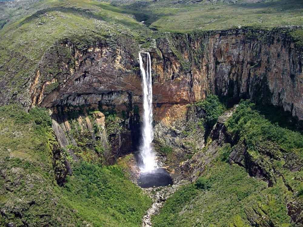
Cachoeira do Tabuleiro. Serra do Cipó.
The Serra do Cipó National Park lies in the heart of the state of Minas Gerais (MG). This national park boasts an incredible diversity of landscapes, from rolling hills and crystal-clear rivers to breathtaking waterfalls and rich flora.
One of the most popular trails in Serra do Cipó is the stunning Cachoeira da Farofa trail. This relatively easy hike leads you through lush vegetation and past various viewpoints, culminating in a spectacular waterfall that invites visitors to take a refreshing dip. As you walk, you’ll likely encounter local wildlife, including colorful birds and playful monkeys, adding to the park’s charm. This trail is perfect for families and those seeking a leisurely adventure in nature.
For more experienced hikers, the trail to the summit of the Pico da Lapinha offers an exhilarating challenge. Rising to an elevation of over 1,800 meters, this trek rewards your efforts with panoramic views of the surrounding mountains and valleys. The ascent can be steep and rocky in places, but the sense of accomplishment upon reaching the top is unparalleled.
Getting threre: The Serra do Cipó is 100 km from the state capital, Belo Horizonte. The route is on a paved road. At the Lagoa Santa junction, turn right towards Conceição do Mato Dentro (MG 10 Highway), after Lagoa Santa, continue for 60 km, the road passes inside the Serra do Cipó.
When to go: The best time to visit Serra do Cipó is during the dry season, which runs from May to September. During this period, temperatures are milder, there is less chance of rain and the waterfalls tend to have a higher volume of water.
Main attractions: Waterfalls – Farofa, Grande, Andorinhas, Gavião, among others. Trails – Circuito das Lagoas, Trilha do Encontro dos Rios, Travessão. Natural Pools – crystal clear waters in several areas of the park. Cânion das Bandeirinhas (Canyon with waterfalls, cascades and natural pools).
Length of Stay: To explore the main attractions, including Serra do Cipó National Park, 3 to 5 days are usually enough. However, if you want to do longer trails or explore more remote areas, you may need more time, such as 6 days or more.
Difficulty: The Serra do Cipó offers a variety of trails with difficulty levels ranging from moderate to difficult, depending on the route chosen. Some trails, such as the Canyon trail (Bandeirinhas), may include stretches with slippery rocks and river crossings, requiring caution and experience.
Facts: Cipó is an important river there. The design of its curves seen from above makes it clear why it has the name, it really does look like a vine; Serra do Cipó is considered a mecca for climbing in Brazil; Formed by the cerrado and Atlantic forest biomes, the region enchanted the great landscaper Burle Marx to the point of calling it the Garden of Brazil.
Fees and rules: Entrance to Serra do Cipó National Park is free. Hiring a local guide is recommended, especially for those who want to explore more remote areas or undertake more challenging activities such as hiking and climbing.
Tips: There are loads of activities you can purtake in Serra do Cipó such as climbing, rafting, horse riding, cycling and rapel. Take your time to enjoy them!
Serra dos Orgaos (RJ) – Tumbs up!
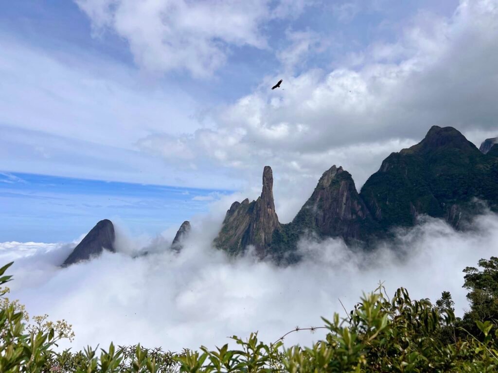
Serra dos Órgãos is a stunning mountain range located in the state of Rio de Janeiro, offering some of the most breathtaking hiking experiences in Brazil. Renowned for its dramatic peaks, lush forests, and vibrant wildlife, this national park is a haven for outdoor enthusiasts eager to explore its diverse landscapes. The area is marked by towering granite formations, with the iconic Dedo de Deus (God’s Finger) standing as a testament to nature’s majestic artistry.
Wildlife enthusiasts will find the Serra dos Órgãos to be a treasure trove of species, making it a fantastic location for nature observation. The park is home to various animals, including capybaras, howler monkeys, and the jaguar. Birdwatchers will also delight in spotting colorful toucans, hummingbirds, and rare endemic species.
One of the most popular hikes in the Serra dos Órgãos is the famous Petrópolis to Teresópolis traverse. This multi-day trek spans approximately 30 kilometers and showcases some of the park’s most stunning scenery. As you navigate through dense forests, rocky outcrops, and “alpine” meadows, the panoramic views of the surrounding mountains will take your breath away. Each step along this trail reveals the rich biodiversity of the region, including vibrant orchids, diverse bird species, and playful monkeys, all inviting you to immerse yourself in the natural beauty.
For those looking for a more accessible adventure, the trail to the Mirante do Saibro offers a shorter yet equally rewarding experience. This hike is perfect for families and beginners, providing a fantastic introduction to the park’s lush environment. Another great option is the Trilha Cartão Postal, a shorter trail offering spectacular views of Dedo de Deus.
Getting there: The main entrance to the Serra dos Órgãos National Park is in the urban area of Teresópolis, with well-signposted access.
When to go: The best time to visit Serra dos Orgãos is during spring and autumn (between April and October) due to the milder temperatures. This is also the driest season, ideal for activities such as hiking and climbing.
Main attractions: The park (the park itself is the primary attraction, offering diverse landscapes, trails, and opportunities for hiking and exploring). Pedra do Sino (the highest peak in the park, offering panoramic views after a strenuous hike). Dedo de Deus (a distinctive rock formation that resembles a finger pointing towards the sky, a symbol of the region). Waterfalls (Cachoeiras) – Veu da Noiva and Andorinhas are particularly beautiful waterfalls within the park. Mirante do Soberbo (a lookout point for views of the mountains and surrounding area).
Length of Stay: For those who want to enjoy the waterfalls and picnic areas, you can spend the day at one of the park’s headquarters. If you want to do longer trails or even a crossing, you may need a period of several days.
Difficulty: The difficulty of the trails in Serra dos Órgãos varies greatly, from easy and accessible trails to challenging crossings that require physical and technical preparation. Some of the most popular trails include the Trilha da Cartão Postal, which is easy and good for families, and the Travessia Petrópolis-Teresópolis, which is considered one of the most beautiful and challenging in Brazil.
Facts: The park has the largest network of trails in Brazil; It is home to the largest number of waterfalls in the state; The Park is the only one in Brazil that is home to more than 2,800 species of plants cataloged by science, in addition to 462 species of birds, 105 mammals, 103 amphibians and 83 reptiles.
Fees and rules: Free entrance to everyone. For some of the more challenging activities and trails in Serra dos Órgãos, it is recommended or even mandatory to hire a guide. The Petrópolis-Teresópolis crossing, for example, requires a guide. On the stretch between Castelos do Açu and Pedra do Sino, the presence of an experienced guide is considered essential.
Serra do Mar (SP) – Drop down.

Serra do Mar State Park is a breathtaking expanse of lush wilderness that beckons outdoor enthusiasts with its stunning landscapes and rich biodiversity. Spanning over 300,000 hectares along the southeastern coast of Brazil, this park offers a unique opportunity to immerse yourself in nature while exploring its myriad of trails. The dense Atlantic rainforest, towering peaks, and cascading waterfalls create an enchanting backdrop for hikers of all skill levels.
One of the most popular routes is the Trilha do Ouro, a historical path that not only showcases the area’s natural beauty but also reveals its rich cultural heritage. This trail leads you through ancient forests, where you can spot vibrant wildlife and listen to the symphony of birds soaring overhead.
For those seeking a more challenging hike, the Serpente trail offers an exhilarating climb that rewards with panoramic views of the surrounding mountains and the coastline. The ascent may test your endurance, but the vistas from the summit are nothing short of spectacular. On a clear day, you can see the shimmering waters of the
Atlantic Ocean stretching to the horizon.
Wildlife lovers will find Parque Estadual da Serra do Mar a paradise to explore. The park is home to an astonishing array of flora and fauna, including endangered species such as the golden lion tamarin, Brazilian muriqui, capuchin monkey, sloth and tapir. As you hike, keep your eyes peeled for colorful butterflies, playful monkeys, and wild cats.
Getting there: You can reach the park leaving from São Bernardo do Campo via Highway SP-148, pass through Cubatão and follow Highway SP-148. You can also make the trip by bus. To do so, buy your bus tickets to Terminal Oswaldo Cruz, in the city of Ubatuba.
When to go: Serra do Mar State Park is open all year round. However, like any other place, it has its best times to visit. Summer, for example, is a wonderful time for those who want to enjoy the region’s waterfalls and beaches. It is also a good time for hiking, as there is little rain.
Main attractions: Trilhas do Rio Itapanhaú (a very difficult hike that runs along the river, with access to small beaches, ferns and Véu da Noiva, the largest waterfall in the region).Trilha Cachoeira d a Boneca / Rio Grande (a trail that follows dense forest, with crystal clear rivers that culminate at Cachoeira da Boneca). Casa Açoriana (a century-old house where workshops, educational activities and events are held). Viewpoints: they allow panoramic views of the region. Waterfalls – Several waterfalls, such as the Desterro Waterfall, the Mato Limpo Waterfall and the Pimenta Waterfall. Núcleo Cunha: protects cloud forests, with large trees and species at risk of extinction, as well as waterfalls. Estrada da Serra /Road Cunha-Paraty (it offers fantastic landscapes, with views of the Atlantic Forest).
Length of Stay: The ideal amount of time to explore Serra do Mar State Park can vary depending on the itinerary and the time you want to dedicate to the visit. For longer trail activities, such as the Serra do Mar Trail, you may need to dedicate up to six days to the total 68 km route. For shorter itineraries, such as the Estrada Velha de Santos, a full day may be enough to enjoy the experience.
Difficulty: The level of difficulty on the trails in Serra do Mar State Park can vary from low to high, depending on the route and the park’s core. Some self-guided trails are considered easy or moderate, while others that require environmental monitoring and a guide are intermediate to difficult.
Facts: The Serra do Mar State Park (PESM) is the largest Conservation Unit in the Atlantic Forest, with 332 thousand hectares, home to 25 municipalities in São Paulo and connecting the forests of the Serra do Mar; It was created in 1977 and expanded in 2010, and is an important ecological corridor for biodiversity.
Tips: The park is divided into nine core areas (núcleo), each with its own particularities and attractions, such as trails, waterfalls, viewpoints and areas for contemplating nature. Núcleo Caraguatatuba: It offers trail and activity options, including the Palmeiras Trail. Núcleo São Sebastião: It covers a large part of the municipality of São Sebastião and offers closer contact with nature. Núcleo Cunha: It has cloud forests with large trees, such as cedar and peroba. Núcleo Santa Virgínia: Offers activities such as rafting on the Paraibuna River and various trails. Caminhos do Mar: It has the Calçada do Lorena, the first road paved with rocks in Brazil, and historical monuments.
PETAR (SP) – Cave yourself in
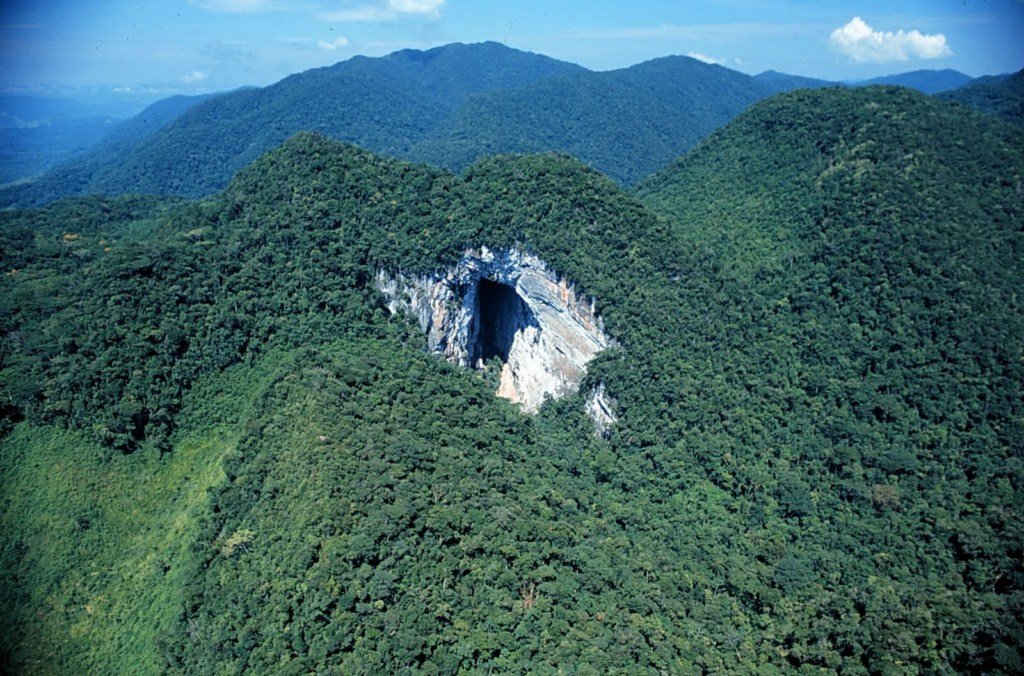
PETAR, Sao Paulo.
Parque Estadual Turístico do Alto Ribeira (PETAR) is a true marvel, offering an extraordinary hiking experience that draws nature enthusiasts from around the world. Nestled in the state of São Paulo, this park is renowned for its stunning landscapes, rich biodiversity, and an extensive network of trails. The park is characterized by its dramatic limestone formations, lush Atlantic rainforest, and intricate cave systems, making it a paradise for those who love both hiking and spelunking.
One of the standout trails in PETAR is the Trilha do Ouro, which leads you through dense forests and offers a glimpse into the region’s mining history. As you hike along this trail, you’ll encounter fascinating rock formations and the enchanting sounds of wildlife. The trail culminates at the stunning Cachoeira do Couto, a spectacular waterfall that invites you to take a refreshing dip. Other popular trails are Trilha do Rio Betari (with access to the Água Suja Cave, Cafezal Cave and waterfalls),Trilha do Morro Preto-Couto (to the Couto waterfall and caves), and Trilha da Pedra do Chapéu. The Betari River Trail is considered one of the most beautiful in the park, due to the riparian forest that protects the river and the cave porticos along the route.

Cave in PETAR, Sao Paulo.
In addition to its stunning trails, PETAR is a hotspot for adventure sports, including rock climbing and rappelling. For those seeking an adrenaline rush, the park’s cliffs provide perfect challenges, with routes for both beginners and experienced climbers.
Getting there: From Sao Paulo City, the route is via BR-116 road to Jacupiranga, taking SP-193 and then in Eldorado SP-165 to Petar.
When to go: The best time to go to Petar is outside the rainy season, as some caves may be closed. Therefore, if possible, try to visit the park between the months of April and November, due to the stable climate.
Main attractions: Caverna Alambari de Baixo (a notable cave in the area, offering a unique exploration experience). Rota das Cavernas (this area features a network of interconnected caves, offering an adventure for those interested in exploring the underground world. Caverna de Santana (one of the largest in the State of São Paulo, over 9 km long). Mirante da Santana (a viewpoint offering panoramic views of the surrounding landscape, providing a great opportunity to appreciate the natural beauty of PETAR). Piscina Natural Rio Betari (a natural pool formed by a river, perfect for swimming and enjoying the natural surroundings). Parque Aventuras (an adventure park offering various activities, including ziplining, rope courses, and other exciting challenges). Reserva Betary (this reserve provides a chance to explore the surrounding natural landscape, including hiking trails and opportunities to spot local wildlife). EcoPark Lago Suspenso (this park features a stunning suspension bridge over a lake, offering breathtaking views and an adventurous experience). Cachoeira do Couto (a beautiful waterfall in the area, perfect for a refreshing dip or a scenic photo opportunity).
Length of Stay: It is recommended to spend 3 to 5 days to visit the main caves.
Difficulty: In PETAR, the trails present different levels of difficulty, from the easiest and most accessible, to the most challenging, which require experience and safety equipment.
Facts: PETAR has 400 recognized caves, but only 16 can be visited by tourists.
Fees and Rules: The entrance fee to visit PETAR is R$38.00 per person per day. It is mandatory to have a guide to visit the Alto Ribeira Tourist State Park (PETAR)
Tips: PETAR is open for visits from Tuesday to Sunday, from 8 am to 5 pm.
Ilhabela (SP) – Get this bite.
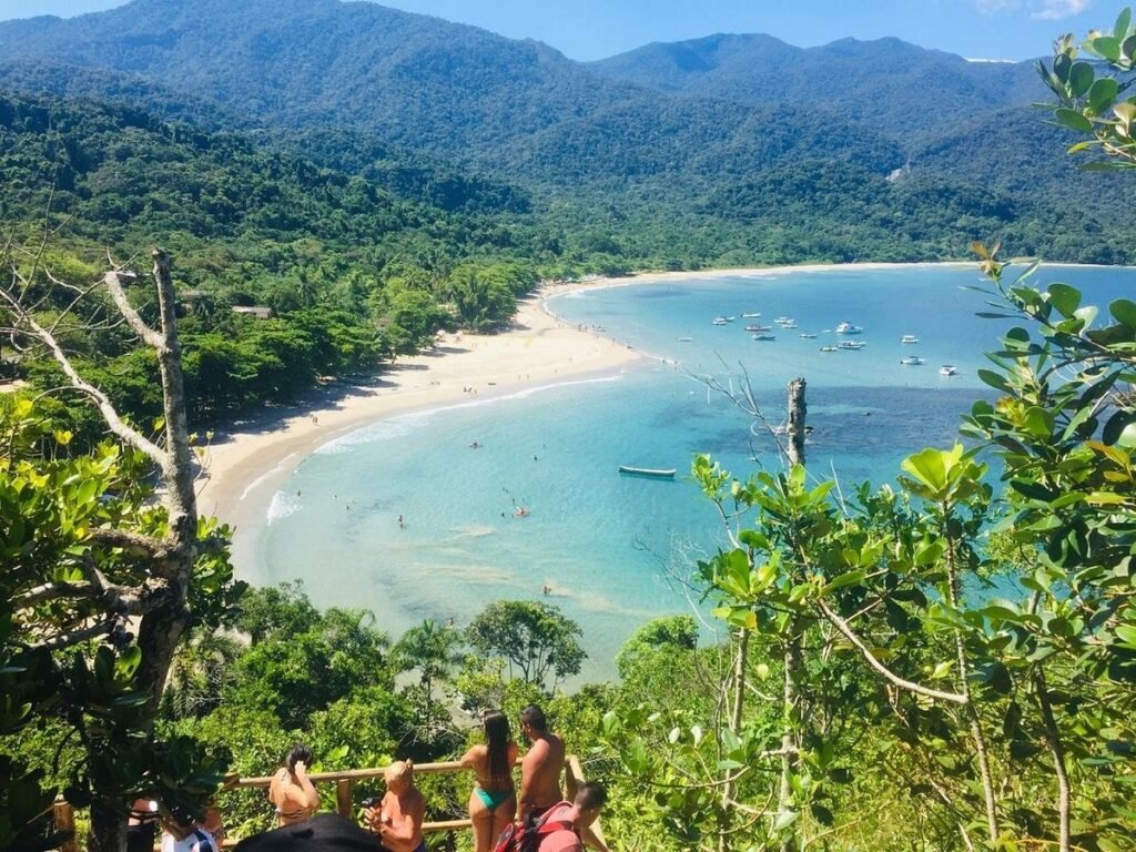
Praia dos Castelhanos, Ilha Bela.
Located on the stunning Ilhabela archipelago off the southeastern coast, this park boasts a diverse landscape that combines lush forests, cascading waterfalls, and picturesque coastal views. The unique combination of trail difficulty levels ensures that hikers of all abilities can find their perfect adventure.
For those seeking a bit of challenge, the Trilha do Pico do Baepi offers a rewarding ascent that culminates in breathtaking panoramic views of the island and the surrounding ocean. The trail weaves through diverse vegetation, showcasing the rich biodiversity of the region. As you climb higher, keep your eyes peeled for unique wildlife, including various bird species and even monkeys.
Explorers should also consider the coastal trails, such as the Trilha da Praia do Jabaquara, where the sound of waves crashing against the rocks adds a different dimension to your hiking experience. This trail leads to secluded beaches, perfect for a refreshing dip after your hike.
Getting there: To get to the island of Ilhabela, you will first need to take a bus to Sao Sebastiao, and then a ferry. A car and passenger ferry runs frequently from Sao Sebastiao to Ilhabela. The ferry operates from 5.30am to 11.30pm, and the trip takes around 20 minutes.
When to go: Ilhabela is a good destination all year round. However, the best time to visit it is from April to August, as there is less rain and the island is usually less crowded. Spring and early autumn offer pleasant temperatures and fewer tourists than summer.
Main attractions: Beaches – Some of the most popular spots include Praia do Bonete, Praia de Jabaquara, Cachoeira Da Toca, and Praia de Castelhanos. Waterfalls: Cachoeira Da Toca (a popular waterfall for its scenic beauty and natural pools); Cachoeira do Gato (another beautiful waterfall, offering a chance to relax and enjoy the natural surroundings); Cachoeira Paqueta (a local favorite, known for its three main stops). Trails – Trilha dos Barreiros (easy / perfect for families and beginners, with a leisurely walk through the forest); Trilha Cachoeira da Laje (easy/ a short trail that leads to a beautiful waterfall); Trilha Cachoeira dos Três Tombos (easy / the shortest trail in Ilhabela); Trilha da Água Branca (moderate / with waterfalls and impressive landscapes); Trilha do Mirante da Baia dos Castellanos (moderate / offers a panoramic view from the top of the viewpoint); Trilha da Praia do Bonete (moderate / wide, well-marked, with the possibility of passing waterfalls); Trilha Cachoeira Laje and Areado (moderate). Trilha do Bonete (hard/ a long and challenging trail, with ups and downs, ideal for those seeking more adventure); Trilha Praia da Figueira (hard).
Length of Stay: For a complete visit to Ilhabela, with time to see the main attractions, such as beaches and waterfalls, the ideal is to stay between 3 and 5 days
Difficulty: In Ilhabela, the trails vary in difficulty level, from easy trails for beginners to more challenging trails for experienced adventurers.
Facts: Ilhabela has a coastline that is approximately 130 km long and has the highest peaks on the coast of São Paulo, including Pico de São Sebastião (1,379 m high), Morro do Papagaio (1,307 m high), and Morro da Serraria (1,285 m high).The region also has approximately 360 registered waterfalls!
Fees and rules: The entrance fee to Ilhabela Island for passenger vehicles is R$19.00 on weekdays and R$28.50 on Saturdays, Sundays and holidays. In general, some trails in Ilhabela require a guide or environmental monitor, especially for more difficult trails or in protected areas. Some more accessible trails can be done without a guide, but it is always recommended to have a guide, especially if you are a beginner or unfamiliar with the region.
Tips: The island is known for having a extraordinary number of mosquitos. Remember to take your mosquito repelent.

Pedra Azul & Monumento Natural dos Pontões Capixabas (ES)
Located in the heart of the state of Espírito Santo, these two areas are known for its stunning landscapes and diverse ecosystems with lush forests, striking rock formations, and vibrant flora and fauna. Although separated by a few ours drive, they showcast a stuning rock formation type named “pontoes capixabas“. While Pedra azul State Park displays an outstanding beautuful example of this formation, the Monumento Natural dos Pontoes Capixabas is an area with the largest cluster of granite pontoons in Brazil, and one of the largest in the world.

As you begin your journey on the Pedra Azul park, the trail welcomes you with a gentle ascent, allowing you to acclimatize to the beautiful surroundings. The path is well-marked, guiding you through enchanting woodlands filled with exotic plants and the sounds of birds singing overhead. One of the most rewarding aspects of this trail is the opportunity to witness the magnificent Pedra Azul itself. This iconic rock formation rises impressively against the skyline, creating a stunning backdrop for your hike. As you ascend, the views become increasingly spectacular, offering panoramic vistas that stretch out over the rolling hills and valleys below.
The best trail in Pontões Capixabas for hiking is Pico da Colina. The hiking trail can be difficult and challenging, with little signage and forks. Alternatively, it is possible to visit Pedra do Camelo and Face da Lua, which offer a trekking trail with spectacular views.
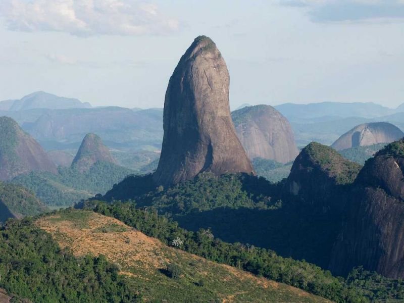
Pontoes Capixabas, ES
How to get there: The town of Pancas is the gateway to the Pontões Capixabas.The most common route to Pancas is from Vitória, the capital, which is 180 km away. You can go by bus or by car. By bus, the companies Águia Branca and Pretti offer this route. By car, follow BR 101-Norte to João Neiva, then head to Colatina, passing through Colatina (without entering the city), and follow the signs to Nova Venécia via Highway ES 080. At the Pancas junction, there is a sign indicating the route.
When to go: Pontoes Capixabas can be visited at any time of the year. However, as it is located in the Capixaba Mountains region, winter ends up being the most popular season for tourists, coinciding with the high season, which runs from June to August.
Main attractions: In Pedra Azul – you can visit the Rota do Lagarto, an 8 km route full of idyllic landscapes, and the Pedra Azul State Park, where you can go hiking and admire the view of the rock. Pontoes Capixabas/Pancas – Pedra da Colina free flight ramp; Pedra do Camelo; Pedra da Agulha; Pedra da Gaveta. Waterfalls- Cachoeira de Pancas; Cachoeira da Prainha; Cachoeira da Bassani; Cachoeira do Moraes; Cachoeira Santa Ana.
Length of Say: To enjoy Pedra Azul, the ideal is to plan a trip of at least 2 days. If you want to explore the region in more depth, including the Rota do Lagarto and the Pedra Azul State Park, consider 3 days or more. Save another 2 – 3 to tree days to visit the Pontoes Capixadas region.
Difficulty: The difficulty of Pedra Azul varies depending on the activity. The main trail to the natural pools is considered to be of medium level, with a 97-meter climbing section with the help of a rope. The climb of the Normal Route is more challenging, with a difficulty level between second and third degree, and some sections of fourth degree.
Facts: Pontões Capixabas is a vast natural area of mountains. But these are no ordinary mountains, they are gigantic granite rocks, similar to Sugarloaf Mountain in Rio de Janeiro.
Fees and rules: Entrance to Pedra Azul State Park is free. The daily visiting limit is 150 people. Access to the trails is only permitted until 2 pm. Pets are not allowed as well as the use of drones. Check-in times for appointments: Morning: 8am, 9am, 10am and 11am. Afternoon: 1pm
Tips: Once in Pedra Azul, consider one of these extra activities: Balloon rides (to enjoy the views of the region); Lavenderia (lavender field with stunning views and lavender ice cream); Reserva Águia Branca (park with activities such as tree climbing, zip-lining and horse riding); Ecoparque Pedra Azul Aventura (offers quad bike tours); Sítio Herança: (farm with tourist activities such as visiting the tea house, plantations and strawberry picking); Sítio Pedreiras (farm with certified organic products); Cachaçaria Modolo (winery and cellar with artisanal ‘cachaças‘).
Serra da Bocaina (SP) – Powerly magic!
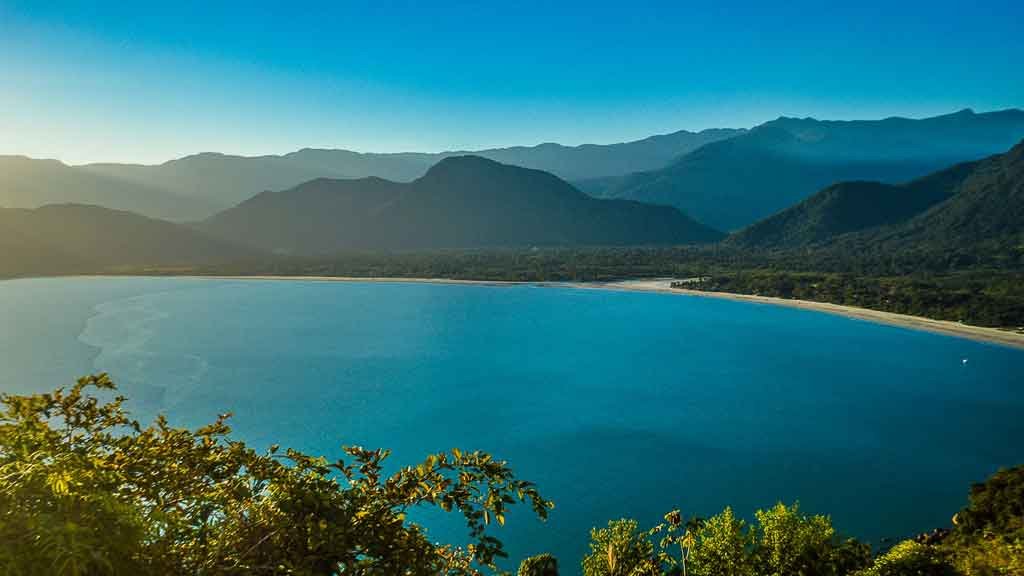
Serra da Bocaina is another beautiful national park with its stunning landscapes and rich biodiversity. Nestled between the states of São Paulo and Rio de Janeiro, it offers a plethora of hiking trails that cater to both novice trekkers and seasoned adventurers. The park encompasses lush forests, rugged mountains, and cascading waterfalls, creating a diverse environment that showcases Brazil’s natural beauty.
One of the most popular trails within Serra da Bocaina is the Trilha do Ouro, or the Gold Trail, which leads you through the remnants of an ancient gold mining route. As you hike along this historic path, you’ll be surrounded by towering trees and vibrant flora, with the sounds of nature serenading you at every turn.
For those looking to immerse themselves in the tranquility of nature, the hike to Cachoeira do Veado is an absolute delight. This trail winds through dense vegetation and culminates at a picturesque waterfall, where you can take a refreshing dip in the crystal-clear waters. As you traverse the trails, keep an eye out for various species of birds, monkeys, and even the elusive jaguar. Birdwatchers will be thrilled by the chance to spot colorful toucans and other avian wonders. The park is a vital habitat for many endangered species, making your visit not only an adventure but also an opportunity to appreciate and protect Brazil’s unique ecosystems.
How to get there: The Serra da Bocaina National Park (PNSB) has its headquarters and attractions in both the mountainous and coastal regions. The main attractions in the mountainous region can be accessed via São José do Barreiro, in the Paraíba Valley. This is also where the main headquarters is located. The coastal attractions are located near Paraty, where the Park’s sub-headquarters is located. MOre information can be found here.
When to go: The best time to visit the mountainous region of Serra da Bocaina National Park is between May and August, when there is less rain. However, this is also the coldest time of year and therefore less favorable for swimming in waterfalls.
Main attractions: Waterfalls – The Serra da Bocaina is home to several waterfalls, including the famous Cachoeira do Santo Isidro and the Chachoeira do Veado, which are must-see stops for those who enjoy contact with nature. Trails – The Trilha do Ouro is one of the highlights of the park, an old colonial path that crosses the region, offering stunning landscapes and the opportunity to learn about the history of the region. Peaks and Viewpoints – Morro do Tira Chapéu offers panoramic views of the park and the region, and is a reference point for lovers of natural landscapes. The Trindade section of the park has beaches and natural pools, ideal for those looking for leisure activities and contact with the sea.
Length of Stay: To properly visit Serra da Bocaina National Park, especially for hiking the Gold Trail, it is recommended to plan for at least 3 days
Difficulty: The difficulty of the trails in Serra da Bocaina varies greatly, from easy walks to challenging trails. Some trails, such as Pico do Tira Chapéu, are considered difficult, requiring good physical fitness and experience in the mountains. Others, such as Cachoeira Santo Izidro, are more accessible and suitable for beginners and families.
Facts: The park is home to several species of animals, including jaguars, maned sloths and 300 species of birds. The creation of the park aimed to protect the Atlantic Forest and guarantee the safety of the Angra I and II nuclear plants.The park highest point is Pico do Tira o Chapéu, which reaches 2,088 meters above sea level, one of the highest points in the State of São Paulo.
Fees and Rules: There is no entrance fee to visit attractions open to the public in the upper part of the Serra da Bocaina National Park (PNSB), accessible exclusively through the entrance in São José do Barreiro, SP. It is not necessary to have authorization to visit the attractions on foot, without staying overnight, within the park. The entrance to the upper part of the park is open daily from 6am to 6pm, with entry permitted until 4pm (5pm during daylight savings time).

2-IN-1 DESIGN
MULTI-POCKET DESIGN
OCCASION: Running Shorts perfect fit workout, gym, running, fitness, training, basketball, jogging, exercise or other outdoor activities, etc.
Southern Escapes
Parque Nacional de Aparados da Serra (RS) – Don’t get cliff-ed out!
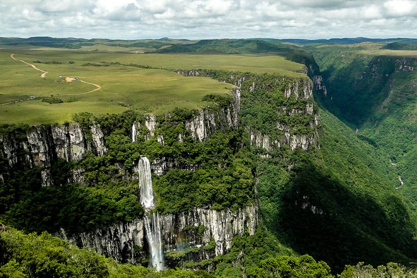
Aparados da Serra National Park, straddling the states of Rio Grande do Sul and Santa Catarina, is renowned for its dramatic canyons, lush forests, and vibrant wildlife. Wildlife enthusiasts will find Parque Nacional de Aparados da Serra particularly enchanting. The park is home to a variety of species, including the elusive jaguar and the playful capuchin monkey. Birdwatchers will also be delighted by the diverse avian population, with opportunities to spot unique species like the red-spectacled Amazon parrot.
One of the park’s most famous features is the Itaimbezinho Canyon, a magnificent gorge that stretches over 5,800 meters in length and plunges to depths of up to 720 meters. The views from the canyon’s rim are nothing short of spectacular, with the lush greenery contrasting beautifully against the rocky cliffs. The hike along the canyon’s edge is both exhilarating and peaceful, allowing you to connect with nature while witnessing the raw power of the landscape. Each viewpoint offers a new perspective, making every step a rewarding adventure.
For those seeking a more immersive experience, the park’s extensive network of trails caters to all levels of hikers. The Trilha do Rio do Boi is a must-try for the more adventurous, leading you down into the canyon to follow the winding river. This trail takes you through dense forests and stunning waterfalls, where you can take a refreshing dip or simply enjoy the soothing sounds of the flowing water.
How to get there: To get to Aparados da Serra, the most common way is by car, especially coming from Porto Alegre or Florianópolis. From Canela, you can take the BR-453 (Rota do Sol) towards Caxias do Sul and then Cambará do Sul. Access to the Aparados da Serra National Park, in Rio Grande do Sul, is 18 km from Cambará do Sul and requires 18 km of dirt road.
When to go: To make the most of the views of the canyons in Aparados da Serra without the fog, the best months are autumn (April and May) and spring (September to November). In summer, the temperature is warmer, but there may be more fog. Winter is also good, with less fog, but temperatures can be low.
Main attractions: Canion Itaimbezinho (the most famous canyon in the region, with a length of 5.8 km and rock walls that are over 700 meters high). Canion Fortaleza (it offers stunning views and hiking trails). Trails – several trails allow visitors to explore the canyons and the surrounding nature, such as the Trilha do Vértice, Trilha do Cotovelo, and the Trilha do Rio do Boi.
Length of Stay: To make the most of your experience in Aparados da Serra, we recommend at least 4 days, especially if you want to visit the Itaimbezinho and Fortaleza canyons.
Difficulty: The trails in Aparados da Serra vary in difficulty, with options for all levels, from easy and fast trails to more challenging trails that require good physical condition. The Vértice trail and the Morro dos Cabritos trail are considered easy, while the Rio do Boi trail and the Cotovelo trail are classified as moderate to difficult.
Facts: Canyons were formed by geological processes that occurred millions of years ago, with the erosion of rocks and the formation of gorges. Itaimbezinho Canyon, which is one of the largest in the Americas, with vertical walls that reach 720 meters high
Fees and Rules: The entrance fee to Aparados da Serra National Park is R$97 per person, plus the cost of parking (R$20 for cars and R$13 for motorcycles). This ticket entitles you to three entrances to any of the canyons (Itaimbezinho or Fortaleza) within a period of seven days..Aparados da Serra National Park has several trail options, and some of them require an accredited guide.
Tips: There are many ecoturism options in the park such as rafting, canyoning, hot air Balloon rides and other nature adventures.
Caminho do Itupava (PR) -Get this ride.
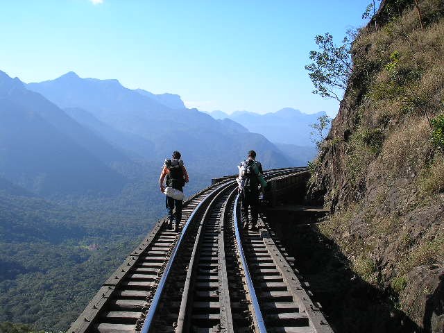
Caminho do Itupava, located in the lush landscapes of the state of Paraná treats hikers with its rich history and breathtaking scenery. This ancient trail, once used by indigenous peoples and later by Portuguese settlers, offers a unique blend of cultural heritage and natural beauty. Spanning approximately 25 kilometers, the path winds through dense forests, cascading waterfalls, and stunning viewpoints that make every step an adventure.
The trail begins in the charming village of Quatro Barras, where you can savor a moment of tranquility before setting off. The first leg of the hike introduces you to the vibrant flora and fauna of the Atlantic Forest, a UNESCO World Heritage site. Keep your eyes peeled for colorful birds, playful monkeys, and the diverse plant life that surrounds you. As you progress along the Caminho do Itupava, you’ll encounter several breathtaking viewpoints that showcase the rolling hills and valleys of Paraná. These panoramic vistas invite you to pause and reflect, offering perfect spots for a well-deserved break or a picnic.
How to get there: The trail starts in Quatro Barras, 27 km from the state capital Curitiba. The easiest way to get to Quatro Barrras is by car or taxi.
When to go: The trail can be done all year round, but it is recommended to avoid the hottest days of summer due to the heat and humidity. Spring and fall are great times for hiking, with milder temperatures and colorful landscapes.
Main attractions: Caverna de Itupava (a natural cave with important historical and religious significance). Ruinas da Casa Ipiranga (remains of an old residence, which recall the history of the region). Cachoeira Ipiranga (a waterfall with natural beauty, which can be accessed by a short hike along the railroad). Curitiba-Paranaguá Railroad (the trail crosses the railroad at several points, allowing you to see the trains passing by and admire the historic engineering).
Length of stay: The Itupava Trail takes an average of 7 to 10 hours to complete, depending on the pace and physical fitness level of the participants. The route is approximately 20 to 28 km long and requires good physical fitness due to the steep climbs and descents. Some adventure companies offer 14-hour tours, but the route is usually done in one day.
Difficulty: The Itupava Trail is classified as an intermediate to semi-hard difficulty trail, approximately 20km long. The trail requires good physical fitness, mainly due to the distance and the presence of steep and slippery sections.
Facts: It was the first connection between the Curitiba region and the coast of Paraná, being opened in the mid-17th century using indigenous trails. The trail is marked by stones that were placed between 1625 and 1654 by Indians and miners, and later by slaves.
Fees and rules: The cost of visiting Caminho do Itupava can vary depending on the type of activity and the travel agency you choose. Some agencies offer day trips that can cost from R$250.00.
Parque Nacional Sao Joaquim and surroundings (SC) – Cold as!
São Joaquim National Park, located in the Serra do Southeast region of Santa Catarina, is one of the most popular destinations for hikers seeking unique experiences in the middle of nature. Covering an area of approximately 49 thousand hectares, the park is home to a rich diversity of ecosystems, ranging from araucaria forests to high-altitude grasslands. This variety provides not only a visual spectacle but also the opportunity to observe several species of local fauna and flora, many of which are endemic to the region. The park is home to several endangered species, including the Paraná pine and the jaguar.

One of the most popular trails in the park is the Morro da Igreja trail, which takes visitors to the highest point in southern Brazil, at 2,892 meters above sea level. Along the way, hikers are treated to stunning views of the rock formations and surrounding landscapes. Another iconic trail is the Pedra Furada trail, famous for its unique geological formation and the panoramic views that unfold along the way. Finally, the stunning Cânion Espraiado is characterized by its dramatic cliffs and lush landscapes, offering a unique hiking experience that promises adventure and natural beauty.
Just outside the park borders, you will find the Trilha do Rio Túnel, located in the municipality of Grao Para (SC). This memorable trail meanders through lush forests and offers breathtaking views of the surrounding landscapes, making it a perfect choice for hikers of all skill levels. One of the highlights of the Trilha do Rio Túnel is the stunning river that runs alongside the path.
The Funil Canyon, located in Bom Jardim da Serra, Santa Catarina, is a true treasure for nature and hiking lovers. With its impressive vertical walls rising over 100 meters high, this canyon offers a hiking experience that combines scenic beauty with a sense of adventure. Along the trail, visitors are treated to stunning views that capture the essence of what it is like to explore the majestic Serra do Rio do Rastro.
Fiinally, The Piramides Sagradas (Sacret Piramitdes) Trail, located in Grão-Pará, Santa Catarina, leads to astunning viewpoint with panoramic views of the rock formations that give the place its name. The trail, which can be done from Pousada das Pirâmides, is considered moderate, with uphill and downhill sections, and requires good physical fitness. The trail is marked by vegetation, rocks and mud, with some areas more exposed to the sun.

How to get there: The park headquarters are located in the urban area of the municipality of Urubici. The Planalto Serrano Regional Airport is used, located in Correia Pinto, near Lages/SC, the closest in the region, located approximately 127 km from Urubici. There is also the possibility of using the Florianópolis/SC airport (Hercílio Luz Airport or Florianópolis International Airport), located 180 km away from the municipality of Urubici and which has more flight options. By car, the main and shortest access (160 km) is via highway BR 282, towards Lages/SC, up to km 146, in the town of Santa Clara, municipality of Bom Retiro/SC. From there, turn left onto highway SC 110, following for 24 km until the urban area of the municipality of Urubici (SC).
When to go: São Joaquim National Park can be visited all year round. Keep in mind that São Joaquim National Park is much colder in winter, with temperatures below zero and even snow.
Must see: Pedra Furada (a natural rock formation, one of the park’s main landmarks). Morro da Igreja (the highest point in the park, with panoramic views and easy access via a paved road). Trilha da Serra do Engenheiro (A trail for hiking, biking and camping). Trilha de Travessia (allows you to cross the park by trail). Cânion do Funil e Cânion das Laranjeiras (natural formations with stunning landscapes). Trilha das Nascentes do Rio Pelotas (a trail to observe nature and the sources of a river. Cachoeira do Avencal (a waterfall in the Urubici region. Matas de Araucária (native forests with ancient trees). Campos de Altitude (vast open areas with typical mountain landscapes). Matas Nebulares (forests that live in environments with constant fog, characteristic of the region).
Length of stay: For a complete visit to São Joaquim National Park, including Pedra Furada and Morro da Igreja, you can plan a 2-3 day visit.
Difficulty: The level of difficulty on the trails in São Joaquim National Park varies greatly, from easy to difficult. Some popular trails like Pedra Furada are considered moderate, while others like Serra do Engenheiro Trail are considered difficult. The São Joaquim National Park Crossing is considered to be of advanced level.
Facts: Created in 1961, it is one of the largest and oldest national parks in southern Brazil, focusing on preserving araucaria forests and high-altitude grassland ecosystems.It is one of the coldest places in Brazil, with negative temperatures and the possibility of snow in winter.
Fees and rules: To go to Morro da Igreja (Pedra Furada), it is mandatory to book and collect the ticket at the ICMBio headquarters in Urubici in advance. Access to Morro da Igreja is free, but spaces are limited.
Tips: The climate in the region is a crucial factor to consider when planning a visit to the park. With temperatures that can vary significantly throughout the year, especially at higher elevations, hikers must be prepared for sudden changes in the weather. During the winter, snow is not uncommon. Therefore, having adequate planning and appropriate equipment is essential to ensure a safe and enjoyable experience.
Pico Paraná (PR) – getting higher

Pico Paraná, one of Brazil’s highest peaks at 1,877 meters, is a great option for outdoor enthusiasts seeking both challenging and breathtaking views. Nestled within the Serra do Mar mountain range, this majestic summit offers an unforgettable hiking experience that combines stunning natural beauty with a sense of accomplishment.
The trail to Pico Paraná trail is approximately 8 kilometers long and typically takes about six to eight hours to complete, depending on your pace and the weather conditions. As you begin your ascent, you’ll traverse through the lush greenery of the Atlantic Forest, where towering trees and colorful birds create a symphony of life around you. The well-marked path offers a mix of gradual inclines and steep sections. The view from Pico Paraná is nothing short of spectacular, with sweeping vistas of valleys and distant mountains that will leave you in awe.
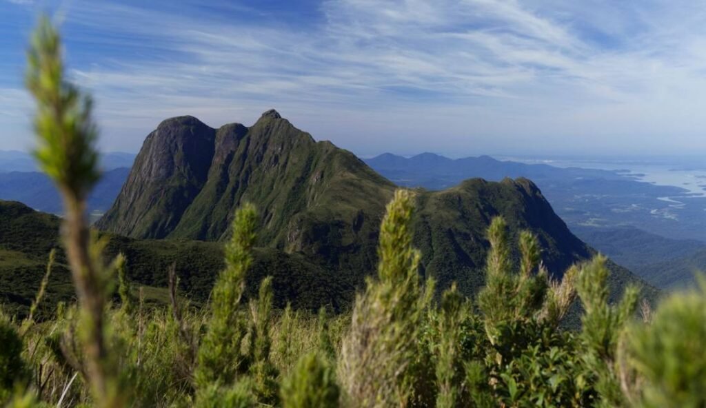
How to get there: Via BR-116, passing Posto do Tio Doca, turn right onto Ponte do Rio Tucum, continuing for 6 km passing through Fazenda Pico Paraná and Fazenda Rio das Pedras until the base of the Instituto Agua e Terra (IAT), end of the road and beginning of access to the trail to Pico Paraná and other peaks in that Conservation Unit.
When to go: The best time to visit Pico Paraná, which has a challenging trail, is from April to August, when there is less rain. This period coincides with autumn and winter, when the conditions of the trail, which has sections of rock climbing, are safer and less dangerous due to the lesser amount of rain and mud.
Main attractions: The main attraction of Pico Paraná is the trail to the top, which offers panoramic views of the region and is a challenge for mountaineers and adventurers.
Length of stay: The acend takes at least 4 hours. The trail, 14.6 km long, has an elevation gain of 1,277 meters and can take up to 12 hours to complete. The trail is considered challenging, with sections of intense climbing, rocks, roots and other obstacles.
Difficulty: This trail has a moderate to difficult level of difficulty, with climbing sections and obstacles. It is essential to be in good physical condition and to bring enough water, as the springs are being restored and the water is not drinkable.
Facts: It stands at 1,877.39 meters (6,159.4 ft) and is composed of granite and gneiss. The area was originally inhabited by Tupi-Guarani indigenous people. German explorer Reinhard Maack discovered the area and made the first ascent of the mountain in 1941. From the top of Pico Paraná, it is possible to see the range of mountains and the bays of Paranaguá and Antonina, as well as Curitiba and the region.
Fees and rules: The entrance fee to Pico Paraná is not free. While access to the park itself may be free, fees are charged for parking and sometimes for access to specific trails or farms that offer trail access. You may also encounter fees for overnight camping. The trail is not recommended for beginners and it is best to go with a guide, especially on weekends or holidays.
Tips: Sunrise at Pico Paraná is one of the highlights of the trail, and is a great reason to wake up early and admire the landscape. It is recommended to divide the trail into more than one day, as there are camping sites available. It is important to plan water well, as there is no water at the camping sites.
Coastal treks
When traveling along the coast, don’t miss out on some great coastal hikes Brazil has to offer. To list some: Rota das Falésias (Northeast); Costa Verde (RJ/SP); Costa Bahiana (BA); Caminhos das Araunas (PB); Volta a Ilha Grande (RJ); Caminho dos Naufragados (SC); Trilha Lagoinha do Leste (SC); Ilha do Mel (PR); among many others.
Urban treks
Brazil also offers an infinity of urban trails within the big cities and capitals. They provide opportunities for walking, running, and cycling, often showcasing the natural beauty and cultural richness of its cities. These trails can promote physical activity while highlighting different aspects of Brazil’s urban environments. Don’t miss them!
Essential Gear for Hiking in Brazil
When preparing for a hiking adventure in Brazil, having the right gear can make all the difference in your experience. Brazil’s diverse landscapes, from lush rainforests to rugged mountains, require specific equipment to ensure both safety and enjoyment. Start with sturdy hiking boots that provide excellent support and traction. Look for waterproof options, especially if you’re exploring areas prone to rain or muddy trails. A well-fitted pair of boots can prevent blisters and keep your feet comfortable throughout your journey, allowing you to focus on the breathtaking scenery around you.
A reliable backpack is another essential piece of gear. Choose one that fits your body well and has ample storage for your gear without being overly bulky. A day pack with hydration capabilities is ideal for shorter hikes, while a larger backpack is necessary for multi-day treks. Remember to pack it wisely, distributing weight evenly to avoid fatigue. An organized pack allows easy access to essentials like snacks, water, and first aid supplies, ensuring you’re prepared for whatever the trail throws your way.
Our Pick
 70L Camping Hiking Backpack with Rain Cover Waterproof Backpacking Backpack for Hiking Treeking Climbing Outdoor
$45.99
|
 King’sGuard 70L Hiking Backpack with Rain Cover Lightweight Travel Backpack Waterproof Camping Backpack
$59.99
|
 TETON 75L Explorer Internal Frame Backpack for Hiking, Camping, Backpacking, Rain Cover Incl
$109.99
|
 MOUNTAINTOP 70L Internal Frame Backpack Camping Backpacking Hiking Backpack for Men Women with Rain Cover
$92.99
|
|
|---|---|---|---|---|
In Brazil’s varied climate, clothing choices are paramount for comfort and protection. Lightweight, moisture-wicking fabrics are ideal for keeping you cool and dry, especially in humid regions like the Amazon. Layering is ke: start with a breathable base layer, add an insulating layer for cooler elevations, and pack a waterproof jacket to shield against unexpected rain. Don’t forget a wide-brimmed hat and sunglasses to protect yourself from the tropical sun.
Safety is a top priority when hiking in Brazil. A good first aid kit is indispensable, equipped with bandages, antiseptic wipes, and any personal medications you may need. Additionally, bringing a reliable navigation tool, whether it be a GPS device or a traditional map and compass, can help you stay on track in remote areas. It’s also wise to carry a multi-tool or knife, which can serve multiple purposes, from food preparation to gear repair.
Finally, don’t underestimate the importance of hydration and nutrition during your hikes. A durable water bottle or hydration system is crucial for staying hydrated, especially in Brazil’s warmer climates. Bring along high-energy snacks like nuts, dried fruits, or energy bars to keep your energy levels up. With the right gear, you’re not just prepared for the journey ahead; you’re ready to embrace the adventure that awaits you.


